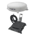
Key Features of IDRS™
- Provides two way on-demand communication links
- Near continuous connectivity with minimal latency
- Supports both mission tasking, mission data, satellite telemetry and command operations
- Leverages the proven Inmarsat BGAN network
- Provides one-stop-shop full service support for provision of space qualified hardware and operational airtime, which is competitive and complementary to current ground network services.
Key Benefits for LEO satellite operators
Real-time Telemetry (providing health and status update for the satellite), Tracking (locating and following the satellite), and Command systems (control and commanding the spacecraft bus and payload of the satellite) to observe and to control the spacecraft’s function and condition from the ground.With IDRS™ solution, it will enable the command centre to further minimize the waiting duration and improve response time over any task.
Earth Observation applications in support of time-critical events, e.g., data alert on change detection, environmental monitoring. With IDRS™ integrated on it, this will enable more effective monitoring and management of the Earth’s resources and enhance the capability for remote sensing observation of Earth from the space with shorter latency and key-holing to increase image yield.
Agile tasking service for emergency monitoring, response and crisis intervention applications that need on-demand information and data over areas affected by natural or man-made disasters such as forest fire.With IDRS™ solution, this could improve the optimization of constellation operation by minimizing the system response time which will enable faster response to better manage crisis accordingly.
Intelligence, Surveillance, Defence applications: security forces that transmit data to Earth observation satellites, aircraft and unmanned aerial observation vehicles, to reconfigure such systems in real time; border control; fishing monitoring, oil-spill monitoring, etc.With IDRS™ solution, the government environmental bodies would be able to monitor the rate of oil spillage in the ocean, size up the affected area more quickly and deploy the damage control operation more effectively.
Weather satellite services that require the fast delivery of large quantities of data around the world, for example, real-time delivery of Radio Occultation data to facilitate accurate “Nowcast”.With IDRS™ solution, this enables the meteorological station to execute on demand request hence increasing the frequency of information updates for a more accurate developing weather condition.
Support for global, real-time mobile platform tracking:
- Maritime – Automatic Identification System (AIS)/DVES.With IDRS™ solution, it will help the operators to receive data at a much lower latency, thus enhancing the alerting and reporting operation while offering real-time tracking.
- Aeronautical – Automatic Dependent Surveillance – Broadcast (ADS-B).With IDRS™ solution, this will further improved situational awareness with on-demand request for information such as detailed weather information and receiving pertinent updates on flight information to reduce environmental impact and improve traffic capacity management.
- Support for global, real-time asset tracking, Internet of Things (IoT), M2M.With IDRS™ solution, this would allow on-demand location tracking/update, on top of the predefined scheduled reporting, for a more up to date real-time asset tracking operation.
Value Propositions
Revolutionizing the way data connectivity is provided for LEO satellite operations, Addvalue’s IDRS™ service offers an unmatched value proposition to all commercial LEO operators.
- “Always On”, Real-Time, On-Demand Connectivity Service for LEO Satellites – 24 by 7 and World’s first on-demand data relay service for commercial as well as government LEO satellite missions
- Low Power, Feather Weight, Cost Effective Data Relay System – Design for viable commercial operation that is light weight and consume low power and hence low investment cost to install and operate
- Improve Operations Efficiency and Optimize Utilization of LEO satellites – Simplify your end-to-end LEO operations, routing client data directly to client’s own processing facilities thus reduces the need for an extensive ground station network
- Relieves The Burden of Frequency Management – Connection frequencies are managed automatically by the Inmarsat BGAN network, allowing fleets of LEO satellites to use the service simultaneously
- Cost Efficient and Commercially Ready – Complements and reduces the need for more global ground station footprint – save on your ground infrastructure and operations costs and shorter commissioning period for new LEO satellites
- Rapid Tasking and Key-holing – Increases value of time sensitive EO images to end-user with shorter latency from order to delivery of images and download of “quick-look” image samples and increases imaging yield
- Faster Response and Recovery – Shorten Initial Orbit Test period and enable faster recovery from anomalies (for Telemetry, Tracking & Command)

